Vermillion Linear Park Natural Resource Management Plan calls for restoration
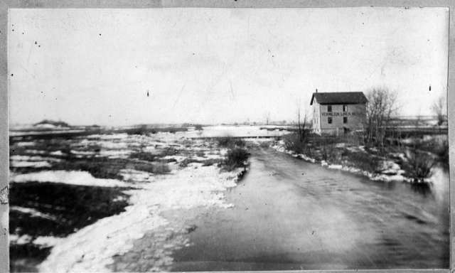
Vermillion Linen Mill, February 21, 1899. This is a view looking west from the Vermillion River Bridge at what would today be Hwy 61 Bridge, capturing what would be most of todays Linear Park property. This is definitely a prairie landscape; note the lack of trees in the photo, except around the mill itself and a few in the distance, perhaps lining the stream.
Photo: Courtesy of Cindy Thury Smith, Curator of the Hastings Pioneer Room, City of Hastings, MN
Native plant buffer planted by Dakota County SWCD along the north side of the river
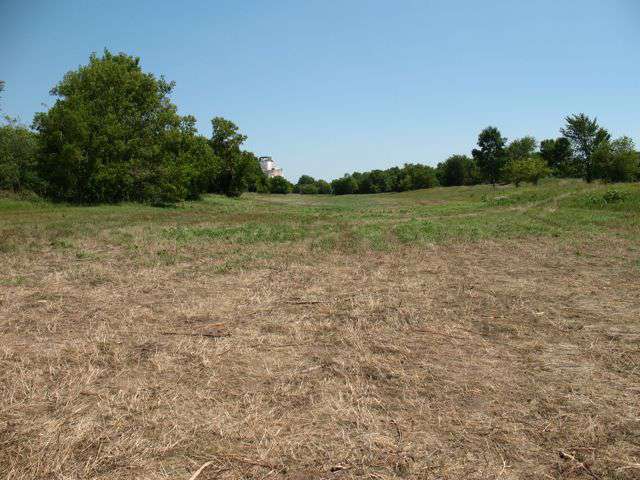
Bypass Channel looking east, with a view of Con Agra in the distance
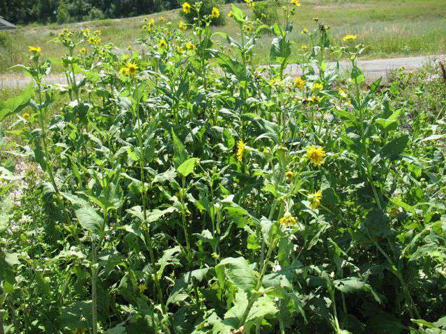
Cup plant, a native shoreland plant found growing in remnants on the site
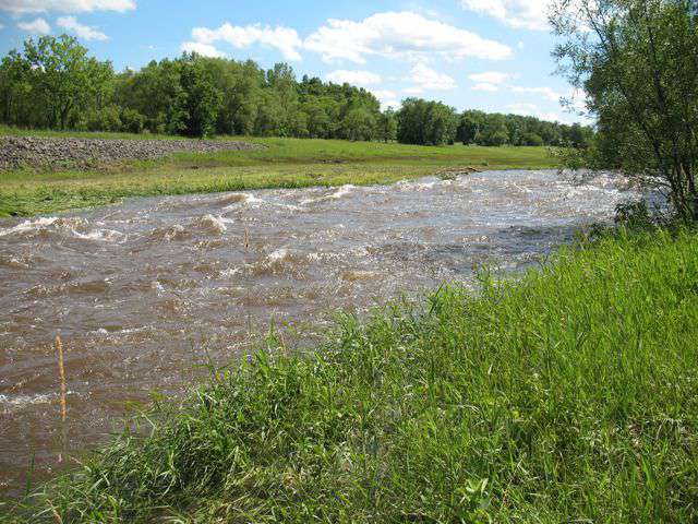
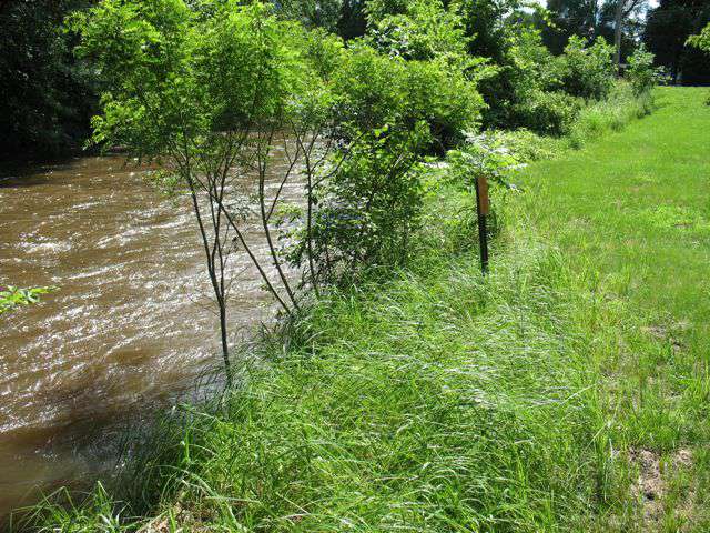
Swift-flowing channel just upstream of Hwy 61 bridge, taken in June of 2012 following a big rain event
The Vermillion Linear Park Natural Resource Management Plan (NRMP), developed by FMR ecologist Joe Walton, presents the site analysis and recommended management and land use activities for the 60.6-acre Vermillion Linear Park Property in Hastings, Minn. The plan was commissioned by Dakota County Farmland and Natural Areas Program (FNAP) as a part of that programs focus on protecting and improving the Vermillion River, but was submitted to the City of Hastings, since they own and manage the park.
The Linear Park property is owned by the City of Hastings. As its name indicates, it is a long, linear piece of property, approximately 3,800 feet long and 600 feet wide. It parallels the Vermillion River and Highway 46-47, from the Highway 61 Bridge to the Hastings Levee.
This site falls within the Metro Conservation Corridors, a regional land protection plan of the Department of Natural Resources. This property is also mapped within the Mississippi Greenway Corridor, a regional land protection plan developed by FMR and local cities and townships. The Linear Park is also part of a chain of city parks that traverse the Vermillion River through Hastings. In addition, the property is included in the Dakota County Farmland and Natural Areas Program (FNAP) natural areas eligibility zone.
The river channel in this reach of the river is very restricted. In response to the record floods of 1965, which flooded a nearby residential neighborhood that had been built on the rivers natural floodplain, a Bypass Channel encompassing approximately 20 acres was constructed south of the channel to divert floodwaters from upstream.
Overall, the topography of the site is rather flat. Bedrock is very close to the surface, and actually exposed at the eastern end of the channel and spillway. Soils vary from deep, floodplain soils that are rarely flooded (at the west end of the park) to sandy alluvial sediments, and sandy glacial outwash (at the east end). No rare plants or animals have been recorded on the Linear Park property, and none were found during recent field work.
The Park has an interesting past. The vegetation of this site at the time just before settlement (1850-1900) was prairie. Many changes have occurred since then. A linen mill was built on the north side of the Vermillion River in the late 1800s and early 1900s, near the present day Highway 61 Bridge. A city dump was located at the western end of the site for many years. The Bypass Channel was built in 1979. These and current situations have impacted the site, including stormwater from the adjacent residential neighborhood that dumps directly into the river. This plan attempts to address these issues, and to pose strategies to help repair past and current damage.
The plan calls for a phased restoration of the site over several years. Restoration activities start with removing invasive, undesirable woody brush (primarily buckthorn, Tartarian honeysuckle, boxelder and Siberian elm) and with controlling exotic invasive herbaceous plants (primarily smooth brome grass and Canada thistle). The plan then recommends performing periodic controlled burns and seeding of local ecotype plant species to restore native prairie. Currently the City of Hastings mows the entire Bypass Channel area at least once a year, and if this area were restored to native prairie, that practice could be discontinued. Stabilizing riverbanks with bio-engineering techniques is also recommended.
If the recommendations of this plan are implemented many benefits would result: the City of Hastings would not have to mow nearly as much as it does now, the habitat of the park would be improved for birds and other animals, water quality of the Vermillion River would improve, and aesthetics of the park would improve for the people who use the park. This park could potentially be a really beautiful natural-area. We are hopeful that the plan gets adopted and subsequently implemented soon.