Culminating three years of engagement, St. Paul City Council gives blessing to Great River Passage Master Plan
For more information on the Great River Passage Master Plan, visit greatriverpassage.org.
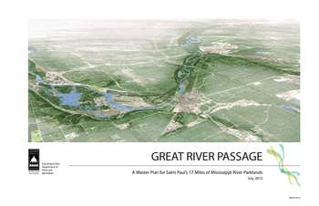
Photo: City of St. Paul
On Wednesday, April 10th, after nearly three years of work, the St. Paul City Council adopted the Great River Passage Master Plan. For the first time, the plan sets forward a coordinated vision for St. Pauls extensive 17-mile-long riverfront. The 309-page document is a visionary guide to future of the riverfront as a key amenity for the city, looking forward 30 to 50 years.
Adoption of the plan followed an April 3rd public hearing, where testimony was widely supportive of the plan, with just one or two exceptions. Kent Petterson, who had a number of concerns with the plan earlier, told the Council that, the plan is leagues ahead of where it was to begin with, and I'm thinking it's looking really good.
The central remaining tension around the substance of the plan was over a planned redevelopment of Watergate Marina at Crosby Farm Park. The plan envisions a redesigned marina and amenities that present a more coherent and accessible public face, including an environmental education center, availability of food and drink, equipment rental and general information at Watergate Marina. As the plan was discussed, opinions were split among stakeholders about whether Watergate could accommodate such changes.
FMR believes such changes could be appropriate. But, as our testimony to the Council noted, we also think its essential that the new facility be done sensitively, modestly and within the existing footprint of the marina. The site is nestled in the river valley near bluffs and some of the most ecologically significant areas in St. Paul's river corridor, areas which FMR has had a hand in restoring.
In the end, the City Council embraced the idea of improving Watergate Marina, amending the plan to specifically call for context sensitive design. FMR agreed to the plan with the understanding the City would make context sensitivity a priority, and will work to ensure those principles are adhered to in future improvements at the site.
Other key highlights in the plan include:
- A calmed, slowed, and redesigned Shepard Road
- Improvements to restore the setting for Hidden Falls Creek in and around Hidden Falls Regional Park
- New recreational amenities at the Island Station site, drawing on the ease of access to the riverfront
- A new river-focused walkway along the edge of the bluff downtown, from the Science Museum to Union Depot, and beyond
- New development and parkland between Wabasha Street and the Lafayette Freeway along the riverfront
- Trails and interpretation at Pig's Eye Regional Park
- A continuous off-road trail system that for the first time ever would connect the northwest and southeast ends of the City through the 17-mile river corridor
- A variety of ecological restoration efforts to deepen the quality of the environmental assets within the river corrridor.
In the media: