New Districts for the Mississippi River Critical Area

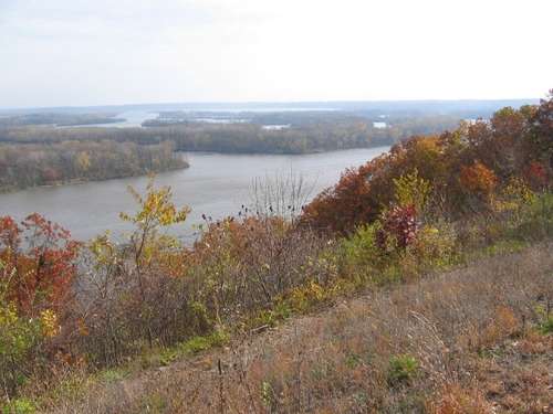
The Pine Bend Bluffs is one of the important and unique parts of the Mississippi River Corridor Critical Area. Looking east from the Pine Bend Bluffs Scientific and Natural Area.
Photo: FMR/Karen Schik
One of the big changes that will be achieved with new rules for the Mississippi River Critical Area is the establishment of new districts for the 72-mile corridor. New districts will provide the foundation and basis for many of the standards and guidelines that ultimately end up in the rules. They will also be the main discussion topic at the next round of Critical Area stakeholder advisory group meetings in late June, where stakeholders will get a chance to review and comment on draft districts with Department of Natural Resources and National Park Service staff.
The Executive Order that designated the Critical Area in 1979 established four land use districts: Rural Open Space, Urban Open Space, Urban Developed and Urban Diversified. When new legislation was passed in 2009, much of the original intent and purpose of the Critical Area was kept intact. But in order to ensure that standards and guidelines would provide greater clarity and specificity, the DNR was directed to establish new districts as part of the rulemaking process. Unlike the original four districts, which were coarse in scale and at times over- or under-protective, the new districts will take the river's diverse geological, ecological and cultural river features into account, in addition to historic and current land-use patterns.
FMR staff will review the draft districts in preparation for the stakeholder meetings the week of June 21st. Stay tuned for an update and/or learn more by visiting FMR and DNR websites on the Critical Area.
For more information,
- about the background of the Mississippi River Critical Area Reform, a significant FMR-led victory
- about the DNRs rulemaking process
- on the March 31st Critical Area stakeholders meeting discussion
- on written comments submitted this spring to the DNR by FMR, other groups and individuals.
River Corridor Program Director Irene Jones