Special Places: Confluences where great rivers merge

Over its entire journey from Itasca headwaters to the Gulf of Mexico, the Mississippi collects 7,000 tributaries — creeks and rivers that flow into the Mississippi and give the river its might.
Each tributary that meets the Mississippi marks a confluence, a flowing together of waters.
These are undoubtedly special places. At confluences, one river’s angle meets another’s, the temperature and velocity of each clash and temper, and the sudden influx of water and all it carries shifts the character of the original rivers. The union of two rivers creates great energy and change.
For our special places feature this month, we're highlighting two confluences you can visit where major rivers change our Mississippi and help make it the mighty river it is.
Bdóte: Where the Minnesota meets the Mississippi

The Minnesota River begins at Big Stone Lake on the Minnesota-South Dakota border. The river collects water running off of 10 million acres of largely agricultural lands during its 335-mile journey to this confluence at Fort Snelling State Park in St. Paul.
This is Bdóte, a sacred place for Dakota people.
Gwen Westerman & Bruce White write in their book "Mni Sota Makoce: The Land of the Dakota": "The place of first creation is at the confluence of the Minnesota and Mississippi rivers, where the Dakota people came from the stars to be on the earth. Two bluffs were formed from the earth, one called Caŝķe Taŋka and the other Caŝķe Cisṭiŋna. The Earth opened herself in that way, and from the mud the Creator made the first Dakota man and woman."
You can learn more from Dakota people about the history and meaning of this place through the Bdote Memory Map before you go.
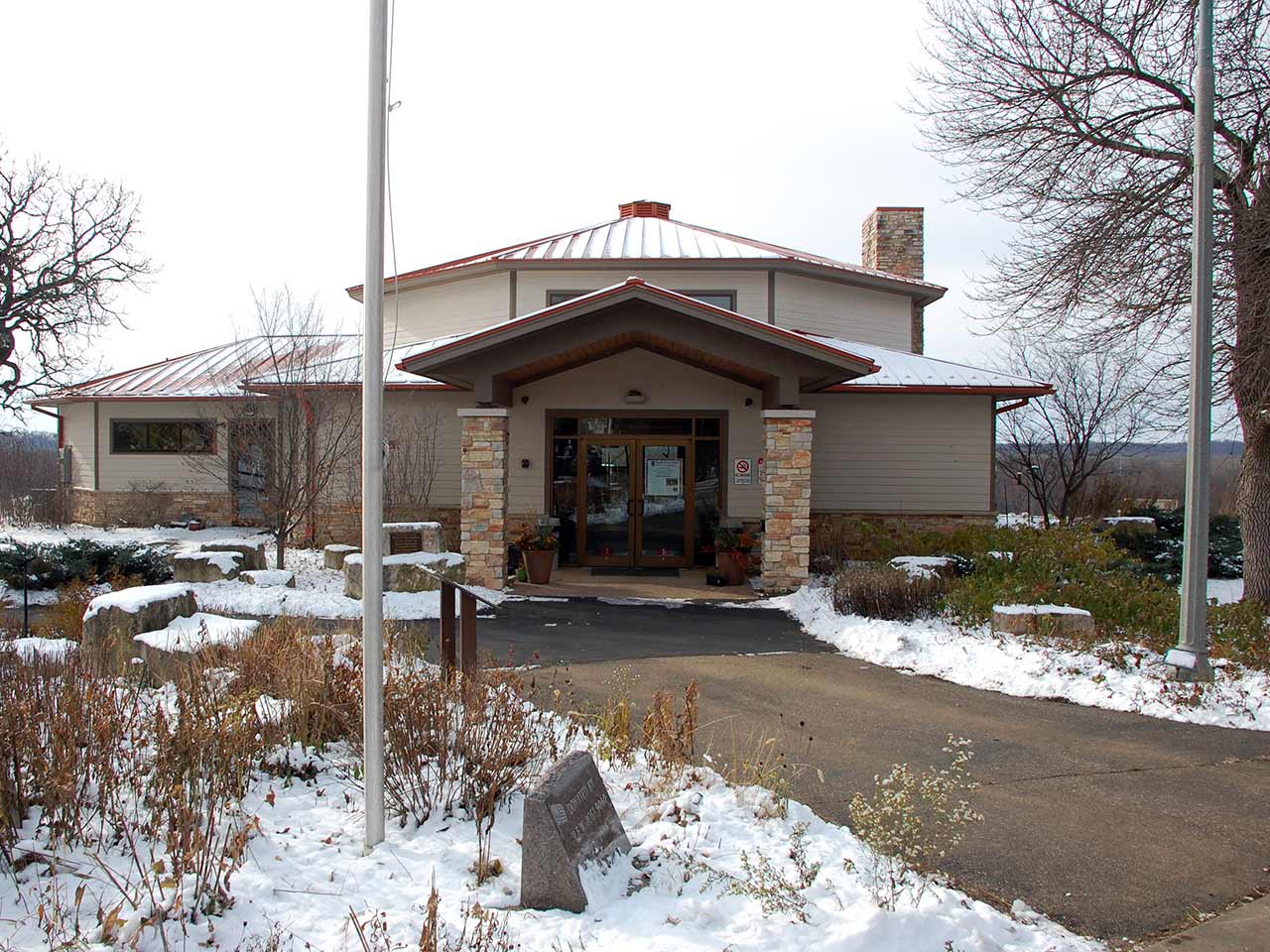
You’ll need a state park pass to visit. Be sure to take time at the visitor center exhibits to learn a little more about the Dakota and the concentration camp that was located just outside of the visitor center. This is where the U.S. government imprisoned more than 1,600 Dakota people through the winter of 1862-1863, and where 300 died.
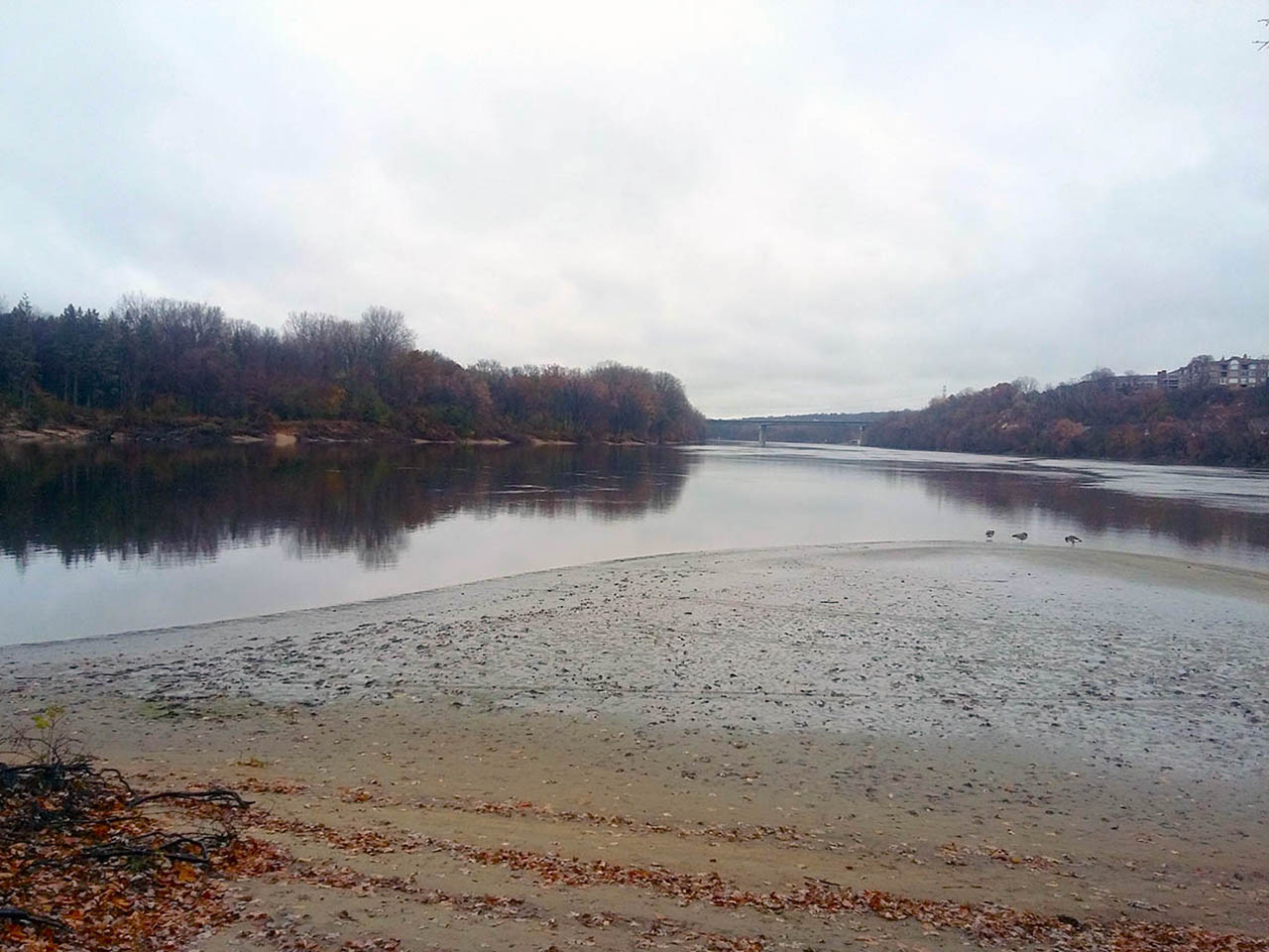
The hiking trail to Bdóte heads past a memorial for this camp, across backwaters and over a bridge onto Wita Taŋka, or Pike Island. The trail loops the perimeter of the island through floodplain forest of cottonwood and ash for about 4 miles. Visitors can often see white-tailed deer browsing and migratory birds following their flyway.
And at the northeast tip of the island, these two great rivers merge. Here is aerial footage of Bdóte from Tom Reiter:
Wild and Scenic joins the Mighty Miss

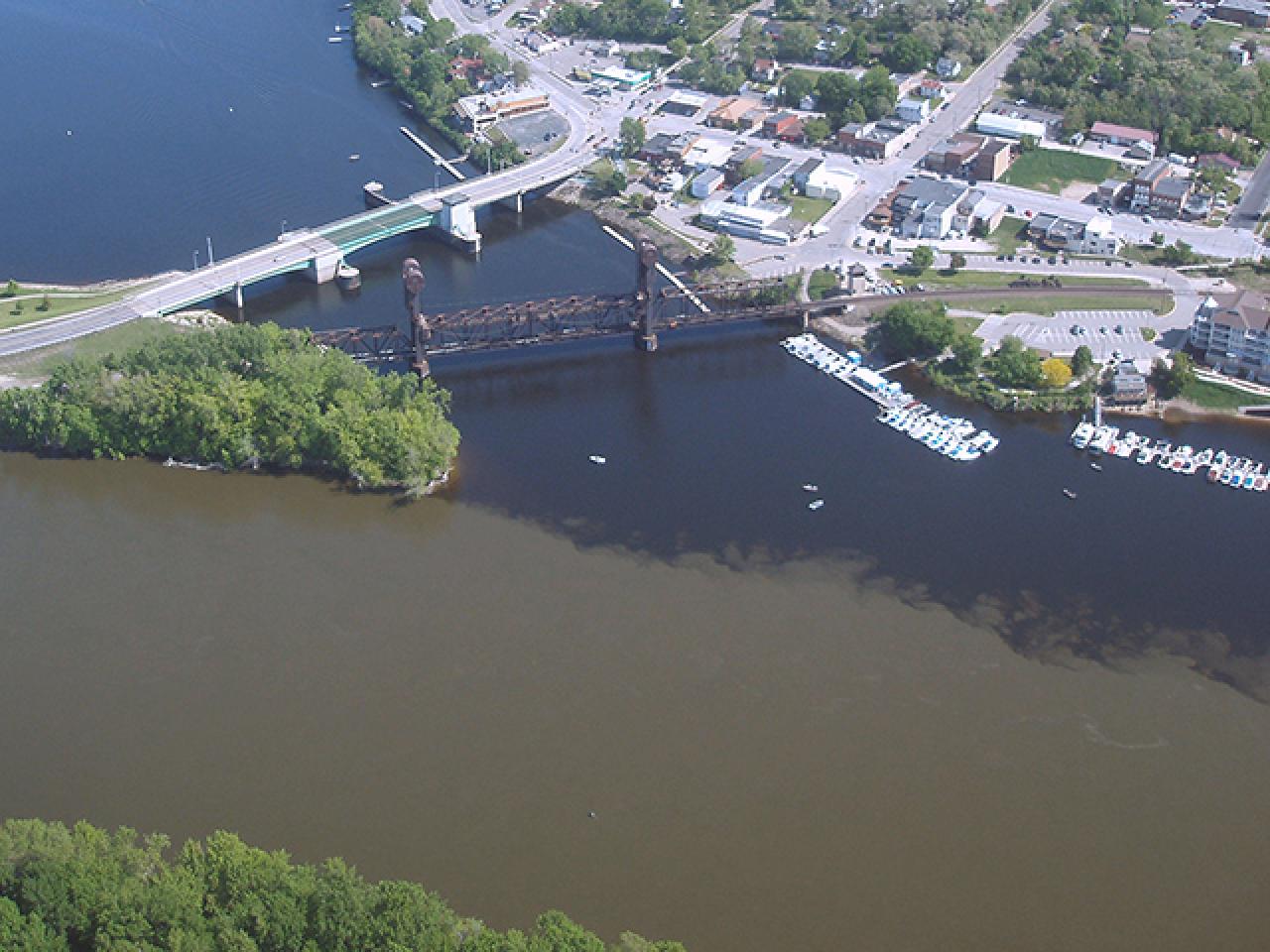
Downstream, the next biggest confluence is where the St. Croix River meets the Mississippi near Hastings.
Above this confluence, much of the St. Croix River is protected. Before you visit, watch this beautiful TPT film celebrating 50 years of the St. Croix as a Wild and Scenic River, produced in part by masterful FMR volunteer Tom Reiter. And to learn more about the St. Croix's conservation history — and the Mississippi’s — read the River Story Map entry by FMR founder Peter L. Gove.
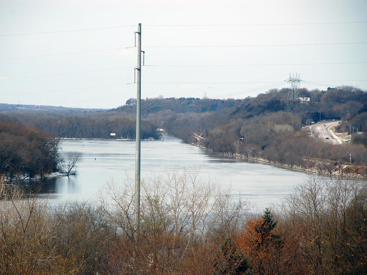
At the Great River Road Visitor and Learning Center in Prescott, Wisconsin, you can see beautiful views of the river valleys and confluence from a 400-foot bluff. The paved trail to this overlook is just a few hundred feet from the visitor center.

It's just a short trip from Prescott back across the river to a whole network of FMR restoration sites, including Hastings Sand Coulee Scientific and Natural Area, home to a rare dry prairie remnant. These sites are part of the Vermillion Creek watershed region. The Vermillion, another major tributary to the Mississippi, also has its confluence near Hastings. (You can join 1,000 Vermillion Stewards to help protect and restore this area.)
More than meets the eye
Each of the Mississippi's 7,000 confluences weaves waterways together. But those waterways carry more than water.
Rain and snowmelt from each creek’s surrounding lands wash roadside litter, gasoline and eroding soil into tributaries. Fertilizers that farmers apply to their fields are rinsed into nearby streams. Industrial chemicals course into creeks and rivers.
One community’s decisions about how to treat the river affects the rest. And all our actions accumulate. The impact is visible, especially at a confluence.
In the video above featuring the Bdóte, the Minnesota River is markedly muddier than the Mississippi, largely due to runoff from agricultural fields. From this point onward, the Mississippi River is so polluted with sediments that the Minnesota Pollution Control Agency classifies it as impaired.
And farther downstream, the St. Croix meets the Mississippi. In the photo at the top of this page, you can probably guess which river is the less-polluted St. Croix, 252 miles of which is protected by the Wild and Scenic Rivers Act.
Though these images clearly show differences in river health, we can’t see the chemicals, microplastics and many other pollutants mixing above. As our State of the River Report shows, more than meets the eye gathers and flows together at each confluence.
Confluences prove our connections and our responsibility to each other. FMR works not only for those that love and depend on the lands and waters here in our metro area, but also for our neighbors all the way down at the final confluence of the Mississippi with the sea.
Zoom in to explore our interactive Special Places Map. Click on the gray stars to learn more about the locations profiled in this article. To view the map full-screen, click the squarish icon in the top right corner.
25 Special Places
This profile of confluences is part of FMR's 25 Special Places project, which we undertook to celebrate our silver anniversary year and the metro Mississippi River in 2018. We've compiled all these places into our Explore the River page, an interactive Google map and set of guides to help you get to know the river that shapes our metro area.
Join us
Our work to protect, restore and enhance the metro Mississippi matters beyond our 72-mile stretch of the river. Become a member today!