How the metro riverfront gained strong, cohesive protections

Strengthened riverfront rules protect bluffs and rugged shorelines like these limestone cliffs, called Robinson's Rocks, on the Mississippi River in Cottage Grove. (Photo by Tom Reiter for FMR)
Hundreds of steel pilings stick out of the ground near the confluence of the Mississippi and Minnesota rivers in St. Paul — the ghost of a development project that never came to be.
In the late 1960s, developers wanted to build two 24-story luxury apartment buildings there, threatening the natural riverfront. Dedicated advocates pushed back, and the plan was abandoned. But the pilings aren't the only legacy from this story. At the time, the river was degraded, polluted and largely inaccessible to many residents. Opposition to that project helped catalyze community advocates urging a different vision for the Mississippi River in the metro, one that could return the river to health and value it as the lifeblood of our cities.
It took decades, but we finally realized a key to that vision in 2025. This is the story of how we got to one of the most far-reaching and important accomplishments for the river since FMR's founding.
An ineffective patchwork of standards
Two official designations honored the river advocates' push. In 1976, Gov. Wendell Anderson signed a state executive order creating the Mississippi River Corridor Critical Area to protect its natural, cultural and scenic resources. Federal recognition soon followed in 1988 for the Mississippi National River and Recreation Area, a national park unit along the same 72-mile stretch.
These designations, though significant, didn't come with airtight legal protection. Imprecise guidelines led to inconsistent approaches to development in each of the critical area's cities and townships. FMR worked alongside community members to advocate for the riverfront they wanted. But Executive Director Whitney Clark, hired in 1997, remembers, "A proposal would come forward for a development that threatened the river's health or public access, and we'd have to scramble to figure out what we could do. It was hard to challenge variances because of the unclear guidelines. We won some and lost some, but it always seemed like we weren't fighting on solid ground."
The patchwork approach wasn't working for environmental advocates, but it was also challenging for decisionmakers and developers to determine what was legal and fair. In 2007, in a bid for clarity, FMR led a study looking into potential fixes for the Minnesota Department of Natural Resources (DNR) critical area program. A series of meetings with business, government and community members pointed to the need for some kind of reform.
FMR began to build support for state legislation that would apply clear, science-based state rules up and down the metro river corridor. Rep. Rick Hansen, Sen. Katie Sieben and FMR staff brought together a working group to take soundings on this idea from legislators, builders, metro city leaders and others. Some worried that state rules would usurp local control. But most recognized that the state rulemaking process was robust and credible.
The 2009 legislative session was busy. Whitney recalls, "We were up at the Capitol constantly, talking to people on both sides of the aisle and pushing for reform." The result was a bill that gave the DNR the go-ahead to create consistent state rules. This was the first win for critical area reform and the official kickoff for a lengthy, involved process that would last nearly two decades. "I don't remember celebrating. I remember immediately starting to think about how we would get the rules done," says Whitney.

Better rules for land use and development along the Mississippi include: protections for scenic views, open space, bluffs, shorelines and more. (Photo by David Wheaton for FMR)
Cohesive rules for the river
It wasn't FMR's job to get the rules done. That was up to the DNR. But since its founding, FMR's job has been to take a seat at the table as a voice for the river.
"If government always did what was good for the river, we wouldn't have much to do," Whitney says. "FMR exists to hold them accountable, to push agencies to do better." Over the next seven years, FMR participated in scores of meetings and spent hundreds of hours reviewing and commenting at every stage.
Irene Jones, former FMR River Corridor Program Director, worked with thousands of local advocates and community organizations to engage in the process as well. "Some community members were willing to learn the nitty gritty and weigh in on planning," she says, fulfilling her original vision for a River Guardians advocacy program, in which "each community has enough people that know and understand the issues and can speak up."
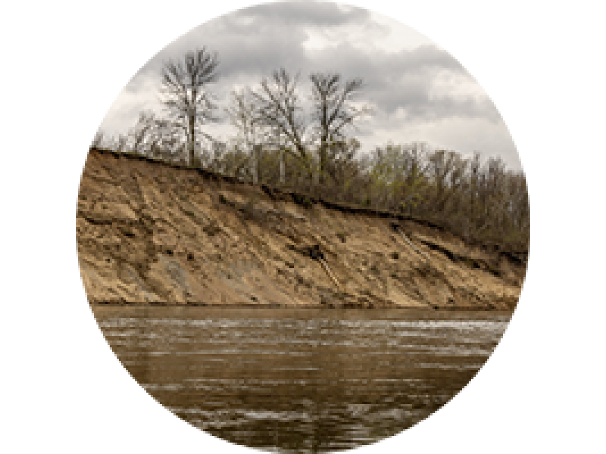
FMR staff participated in scores of meetings, reviewed and commented at each stage, staying attentive to details that would make a big impact on the river. Irene notes with pride FMR's work toward a clearer, expanded definition of what constitutes a "bluff" — eliminating a loophole and including short, steep slopes and rock formations like Robinson's Rocks near Grey Cloud Island. A better definition, paired with building setback rules, would mean more protection for rugged shorelines, sensitive bluffs and the waters below.
What do the riverfront rules guard against?
Find out how the updated, improved rules will protect the metro Mississippi River — and how they already have.
Not everyone wanted state rules that favored public access to the river, bluff protections and scenic views over unmitigated development. In 2011, an attempt to repeal the bipartisan critical area reform bill arose. FMR — in concert with other organizations and river advocates — managed to fend it off with the help of a veto from then-Gov. Mark Dayton.
Whitney and Irene also remember heated community meetings over property rights. But FMR didn't advocate for blanket standards that some opponents imagined. Whitney remembers sessions poring over GIS maps projected on a screen, figuring out how the rules might account for unique geography and existing development. FMR proposed distinguishing more districts, each with its own standards, so state rules could be tailored differently for downtown St. Paul versus open space in Hastings or a neighborhood in Brooklyn Park.
These tailored state rules, FMR thought, could guard against towering, out-of-place developments in places like the river gorge. Setting riverfront building height limits, plus open space and vegetation management requirements, would mean that the ribbons of green along shorelines could run uninterrupted, the feeling of immersion in the more-than-human world preserved and accessible.

It wouldn't make sense to have the same standards for the river gorge as downtown St. Paul. That's why the critical area was broken up into six districts, each with appropriate rules for its features.
Persistence pays off
Finally, after 10 years of listening and balancing interests, the DNR released the final rules in 2016. Thanks to decades of river advocacy, people across the political spectrum could understand the draw of our stretch of the Mississippi, the sense of place it gives and our responsibility to sustain its health as it sustains ours. An administrative law judge thoroughly reviewed the package and gave the stamp of approval, and in 2017, the Legislature passed cohesive, protective development rules for the 72-mile stretch of our metro Mississippi River.
Reflected in the package were many measures FMR championed, delivering a much-improved overall baseline for river development.
FMR supported the 25 cities and townships in the critical area to fold the rules into their plans and adopt official ordinances, some with even stronger protections, like bird-friendly lighting requirements for riverfront buildings. "Ordinance adoption is where the rubber meets the road," Land Use & Planning Director Colleen O'Connor Toberman says. "It's when all this work becomes enforceable." All 25 cities and townships finished this process by the end of 2025.
Coordinated land use planning and regulation reform over nearly two decades may not be what many have in mind when they think about change-making. But Colleen notes, "There's real power in an organization that understands the process, understands the law, gets into the details and has the consistency to stick with it for 20 years."
Whitney adds, "The aspiration of the founders of FMR was that there would be an organization of people waking up every morning thinking about what we need to do to protect the river today. FMR initiated and led this work. These protections wouldn't have happened without FMR and our supporters."
Whitney and Colleen point out that grant funding to support this kind of advocacy is almost nonexistent. This work has been mostly funded by FMR members.
The development we won't see
"One of the things that will be hard to prove is what didn't happen because of these rules," says Whitney. Colleen could think of a few instances when developers knew critical area reform was on the horizon and complied in advance. But ultimately, the impact of critical area reform will be in what we see less of along the river: bluff erosion, clearcut shorelines, outsized new development without public access or open space, sky-high buildings disrupting natural views.
We won't even see the start of such projects. Those steel pilings from 1968 remain, abandoned to the floodplain forest on the banks of a healthier Mississippi River. Now, they're relics from the era that sparked this effort, a reminder that this type of out-of-place development is a thing of the past.
Become a River Guardian
Sign up and we'll email you when important river issues arise. We make it quick and easy to contact decision-makers. River Guardians are also invited to special social hours and other events about legislative and metro river corridor issues.